
|
|
||
|
|
||
|
|
||
|
|
When the Maryland and Pennsylvania colonies were formed, the boundary between the two was a bit suspect, in that people in both colonies didn't always agree on exactly where the boundary was. This became particularly troublesome when Maryland's claim extended far enough north to include Philadelphia.
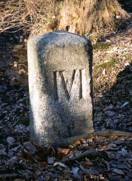 To head off big trouble, a pair of Englishmen named Charles Mason, an astronomer and mathematician, and Jeremiah Dixon, a mathematician and surveyor, set out to have the last word on the subject. For four years, beginning in 1763, the two men walked along the boundary and set things right, extending a very real boundary in the form of stone markers set in the ground every mile. A "crownstone" was set every five miles, with one side showing the coat of arms of Pennsylvania's William Penn and the other side showing the coat of arms of the Calverts, Maryland's founding family.
The Mason-Dixon Line, as it came to be known, extended from the Delaware-Maryland-Pennsylvania triangle into what is now West Virginia (but was then Virginia), nearly 300 miles to the west. People in all four colonies agreed to recognize the boundary.
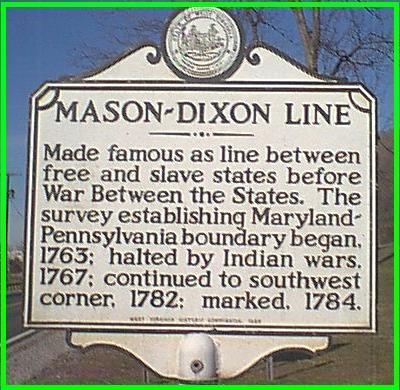 As the issue of slavery became more and more contentious, the people of the various U.S. states began to think of themselves more and more as living above or below a certain "line." The Mason-Dixon Line became a convenient dividing line between North and South.
Even though the disputes between Maryland and Pennsylvania are long gone and the Civil War long over, the Mason-Dixon Line remains, in the form of the milestones and crownstones, most of which are still standing and now protected by iron cages.
|
Search This Site

Custom Search
|
Social Studies for Kids
copyright 2002–2026
David White