
Maps
of U.S. History
See how
the United States got to be the way it did with these
helpful, colorful maps.
13
Colonies Map
This helpful map shows all 13 Colonies, including the
Georgia Territory and what would later become Maine.
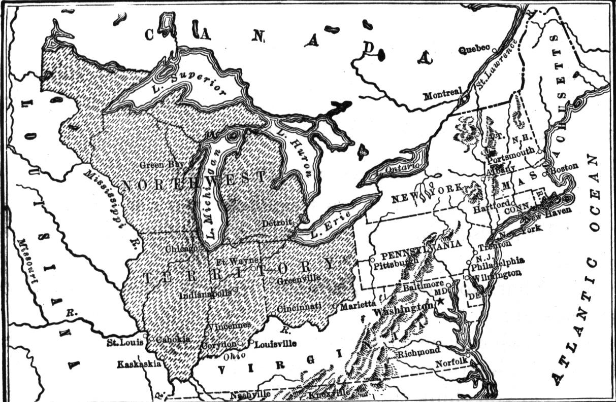
Northwest
Territory Map 1787
The Northwest Territory was one of the first big land grants
to expand the boundaries of the United States. See which
states came out of this territory.
U.S.
in 1800
See the state of the Union in 1800. This was a mere three
years before the Louisiana Purchase, which doubled the size
of the country.
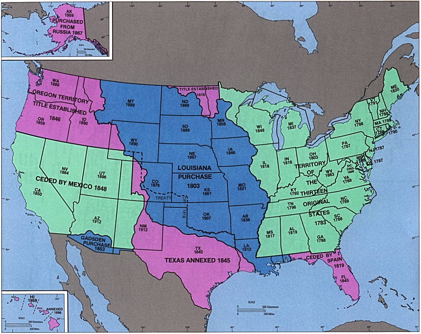
Admission
Dates of States and
Territories
Ever wondered when your favorite state came into the Union?
You can find out here, on this list in the form of a
map.
Maps
of U.S. Wars
See the places and dates for wars fought by United States
armed forces.
Exploration
and Settlement of the United
States
See the United States come together by viewing the same map
at different times in history!
|
