Maps
of Continents

See the
big picture as you look at these maps showing you entire
continents.
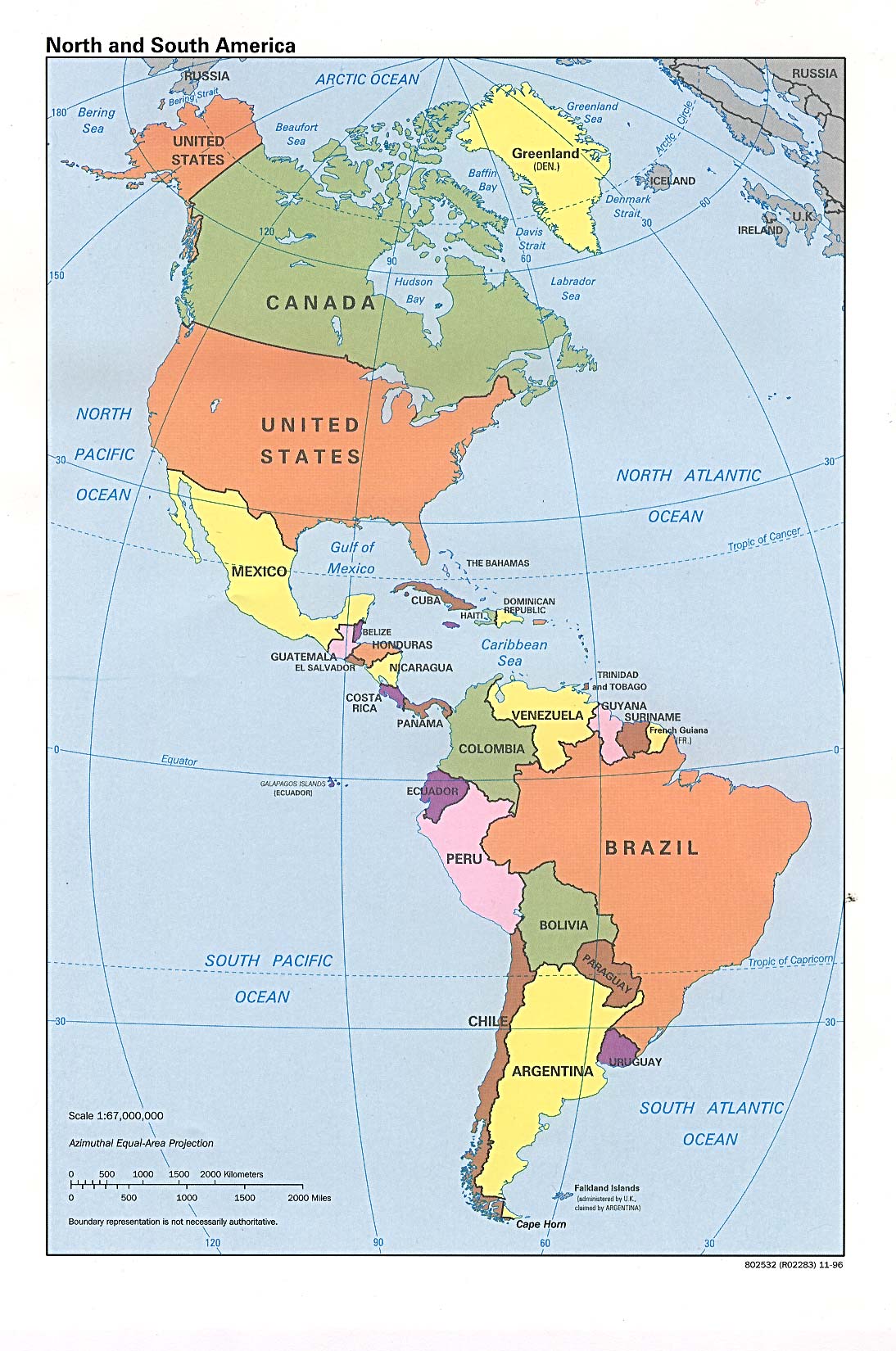
North
and South America
See them both together, including Central America.
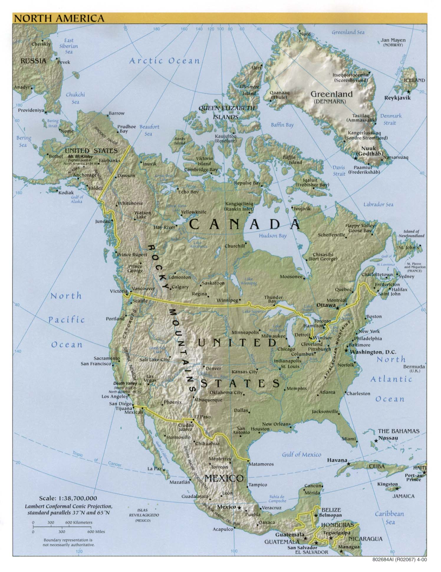
North
America
This map highlights North America and shows cities and
mountain ranges, too.
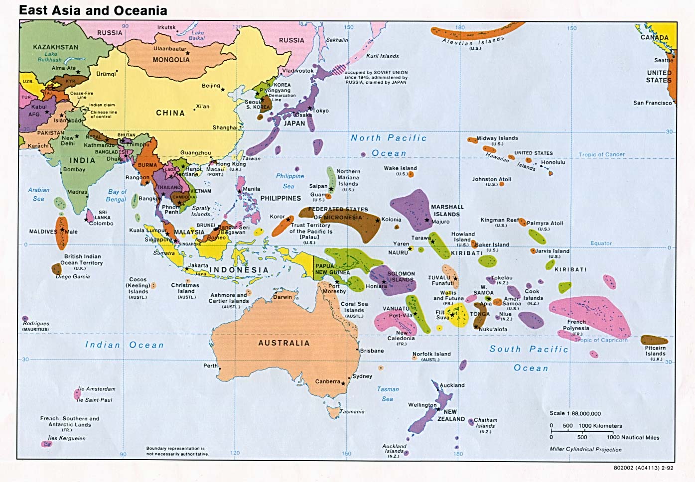
East
Asia and Oceania
This map shows Asia, from Kasakhstan east, as well as much
of the Pacific and its countries, including Australia and
New Zealand. You can find Hawaii here, too.
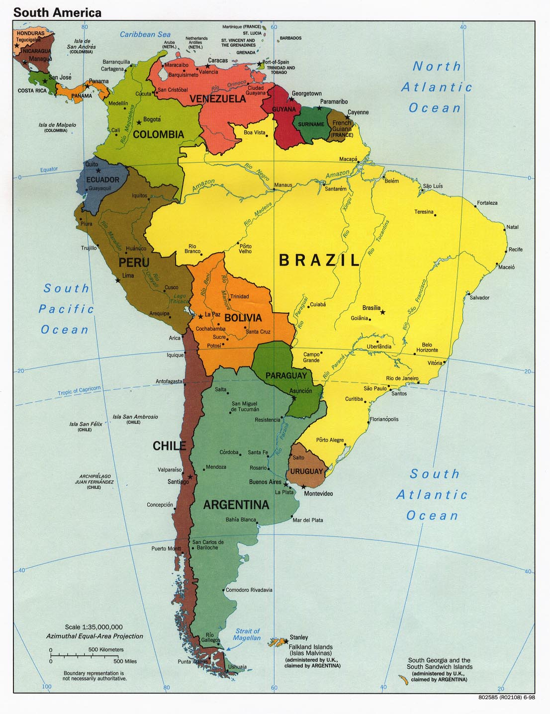
South
America
This map focuses on South America and shows countries,
cities, and rivers.
Central
America and the
Caribbean
This map focuses on Central America and shows cities and
countries.
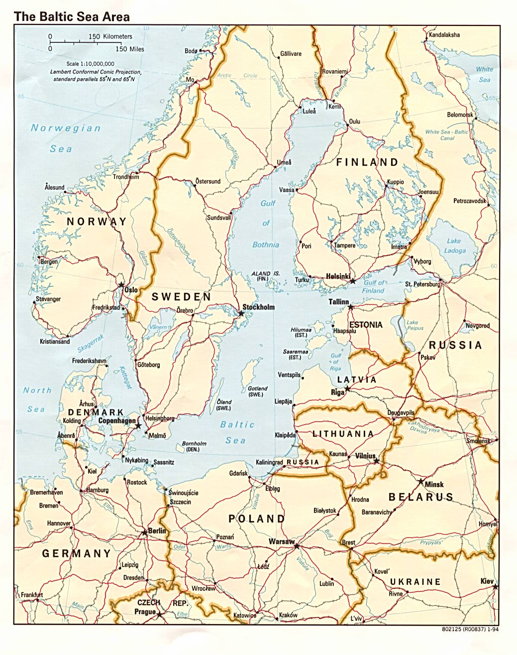
Baltic
Sea Area
This map shows Scandinavia and Estonia, Latvia, and
Lithuania. It even shows roads and railroad lines!
Africa
See all the countries and boundaries of Africa, as well as
many of the cities and rivers.
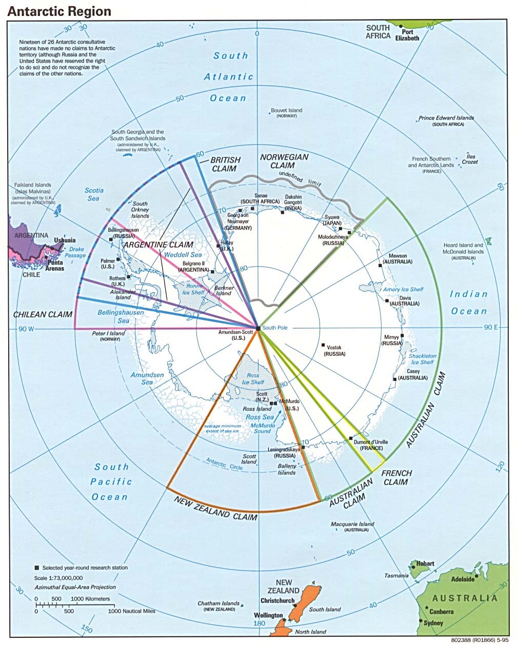
Antarctica
Map
See the coldest continent, including islands and political
settlements.
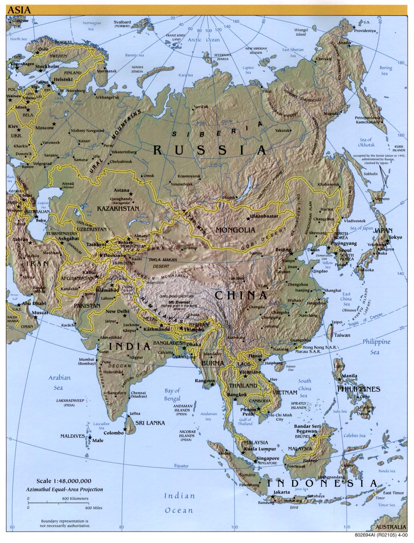
Asia
Political Map
This map focuses on Asia, including cities, mountain ranges,
and bodies of water.

