The Inca Road
The Inca Road was a compendium of improved and new roads, stretching from the northern to the southern ends of the far-flung South American civilization that dominated the west coast of the continent for a handful of centuries in the early Middle Ages. 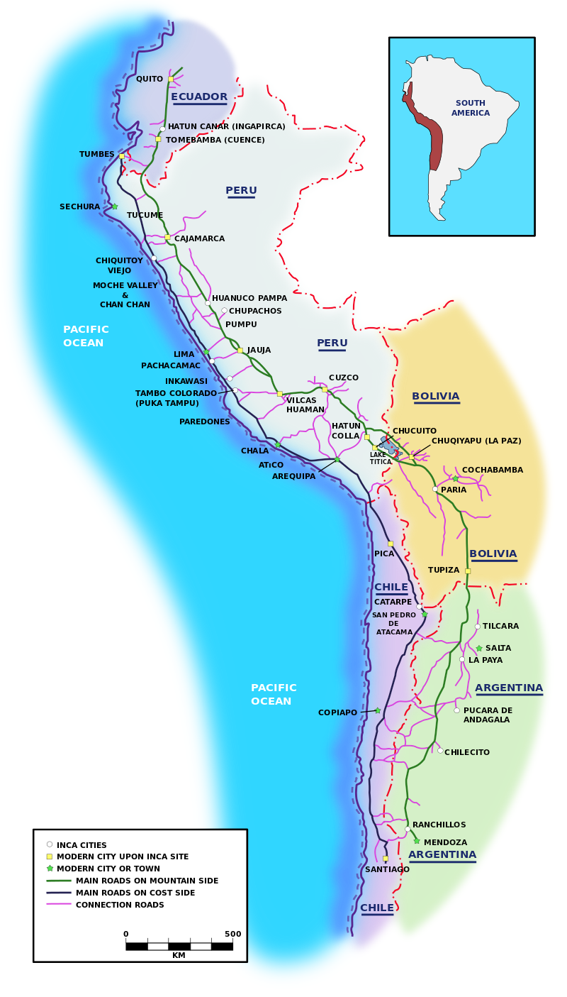
The Inca Empire was long from north to south and comparatively thin from west to east. Two main roads covered the 2,000-mile distance from north to south, one on the western side, nearer the Pacific Ocean, and the other on the eastern side, nearer the Andes Mountains. A network of joining roads stretched west to east at various intervals all along the way. The result was a total of 25,000 miles of roads, bridges, causeways, and tunnels that wended their way through terrain lush and harsh. Some of this was existing; the rest the Inca had built. At the center of it all was Cuzco, the Inca capital. At its height, the city had a population of 150,000, making it one of the largest cities of the world at that time. The Inca Road was rather restricted. Only the wealthy or those who had royal permission (such as messengers) could travel along the road. Anyone from a lower class seen along the roadway would likely part of the crews continually cleaning and repairing the roads. As remarkable as the Inca civilization was in many ways, it did not have wheeled vehicles. Traffic along the Inca Road was on foot, human or animal. Human messengers ran at great speed along the road, carrying pronouncements or other communications to the far reaches of the Empire. Every 10 or 12 miles was a way station, and messages often traveled by relay, with a new runner taking the message at some point and then running to the next, handing off to another runner, etc. Many of these messages were verbal; others featured the quipu, a system of knotted strings that served the function of a written language for the Inca. The use of relay runners meant that a message could travel as far as 150 miles in one day. 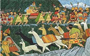
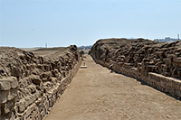
As needed, of course, armies traveled along the road, keeping order throughout the Empire. Also traveling by foot along the Inca Road were the alpacas or llamas that served as pack animals for the Inca civilization. These animals carried goods for traders, who would have had permission to travel along the road. Traders and their animals could enjoy some form of hospitality at the numerous way stations, which included options for food, lodging, and supplies. Roads varied in width. Some were only a few feet wide; important roads in large settlements often stretched 40 feet from one edge to the other.
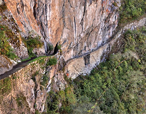
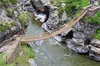
Stone was a major component of much of these roads, but a large number of miles of road were natural dirt pathways, often edged by stone, individually or as walls. As did the Romans, Inca engineers much preferred straight roads. When such an outcome wasn't possible, the Inca built stairways down steep slopes and switchbacks to offset treacherous descents. As well, they used ropes to build suspension bridges across ravines. The people who built all of these roads and ancillary elements used bronze, stone, and wooden tools. Inca engineers also tamed the landscape by building bridges over rivers and streams and drainage systems and, in some cases, walls to keep water off the roads.
|
|


Social Studies for Kids
copyright 2002–2026
David White