Massive World Map Whole Again after 430 Years
December 10, 2017
A 430-year-old map that could fill a room is now available in full form online.
The map, which measures more than nine feet on a side, shows Earth from what is called a polar azimuthal view, looking directly down on the North Pole from space, with the lines of longitude coming out from the Pole. Such a projection became popular when air travel came into vogue but was not widely used in Monte's time. The atlas resides in Stanford University's David Rumsey Map Center. The website for the center has digital images of the map's contents, along with a virtually stitched together full world view. The center recently added the atlas to its collection; only three other versions of the map are known to exist. An author and avid collector, Rumsey donated his vast collection of maps to Stanford in 2016. The center contains more than 150,000 maps, from wall maps to pocket charts. Nearly half of those items are, like the Monte map, now online. |
|


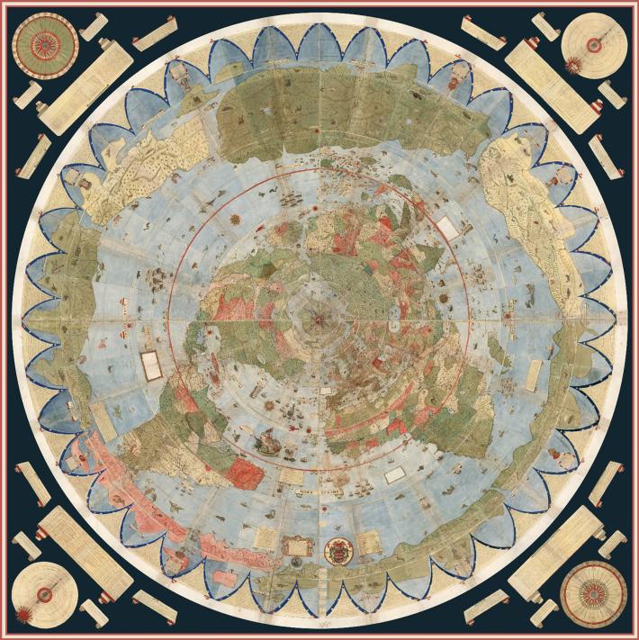 The 60 individual sheets that make up the 1587 world map drawn by Italian mapmaker Ubrano Monte has for many years been bound together as an atlas; they were intended to be one giant image, however. After painstaking scanning of each page with an eye toward reconnection, geographers can now see the original image as it was intended to be displayed.
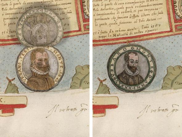 The map shows the land and water of Earth as Monte and other geographers at the time understood it. The circumnavigation of the Ferdinand Magellan expedition 60-some years before provided some welcome updates. Monte even included two portraits of himself on the map, one when he was 43 and the other when he was 46.
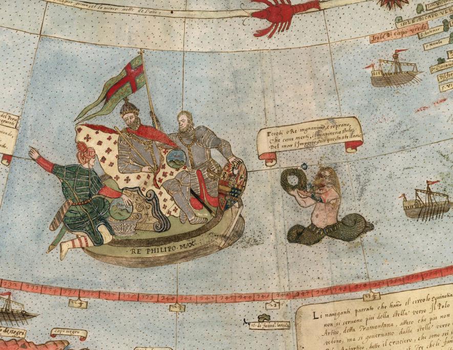 Like other maps of the time, however, Monte's map includes some fanciful elements, like fantastical creatures roaming the lands and seas. Spain was a world naval power at the time, and the map portrays King Philip II on an approximation of a floating throne.

Social Studies for Kids
copyright 2002–2019
David White